Our drone photography and videography services provide stunning, high-resolution aerial views that ground-level photography can't match. Perfect for personal or commercial use, we use state-of-the-art drones to capture unique, eye-catching content from above.
Elevate Your View: Stunning Aerial Photography & Videography
Aerial Photography: Get breathtaking aerial photos of landscapes, properties, events, and more. Perfect for real estate, tourism, and nature documentation.
4K Videography: Our drones capture ultra-HD (4K) videos, delivering smooth, cinematic footage ideal for marketing, promotional videos, and event coverage.
Real Estate Showcases: Showcase properties with high-quality aerial footage, highlighting all features and amenities for potential buyers.
Professional-Grade Equipment
Experienced Drone Pilots
Tailored Solutions
Only Hire Licensed and Insured Pilots
49 USC 46306(b) says if you hire a non licensed pilot you can be prosecuted.
DRONE DETAILS
A Fleet of Drones Drone Technologies To Get Best Results We The Right Drone For The Project
Flight Time
30 min - 45 min with extra batteries
Pixels Resolution
48 MP
Software Enhanced
Footage processed professional tools
Ultra HD Video
We shot in 4K 60FPS
SERVICE
Explore What We Offer
Aerial Photography
Get breathtaking aerial photos of landscapes, properties, events, and more. Perfect for real estate, tourism, and nature documentation.
Real Estate Showcases
Showcase properties with high-quality aerial footage, highlighting all features and amenities for potential buyers.
4K Videography
Our drones capture ultra-HD (4K) videos, delivering smooth, cinematic footage ideal for marketing, promotional videos, and event coverage.
Construction Monitoring
Capture regular aerial updates of construction sites to track progress, manage timelines, and share updates with stakeholders.
Event Coverage
Document events such as weddings, concerts, and sports events from unique angles, providing a memorable experience for viewers.
Agricultural Surveys
Conduct aerial surveys for crop health, land mapping, and resource planning, optimizing agricultural efficiency and land management.
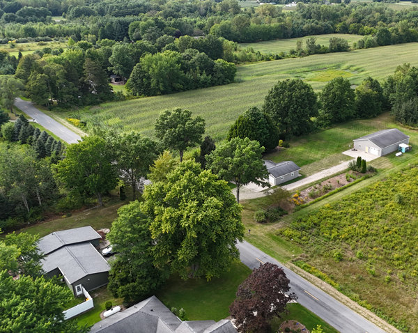
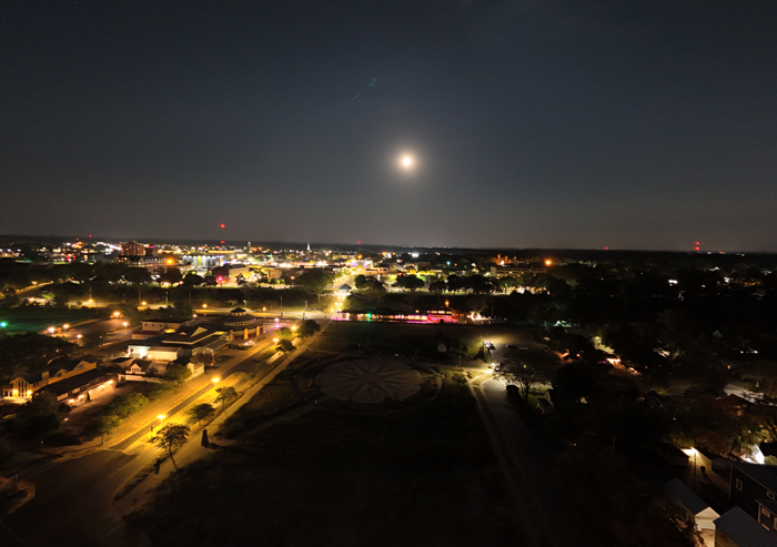
Explore some of the stunning aerial shots captured by our drones. Our portfolio showcases our expertise in delivering high-quality images and videos, whether it’s urban landscapes, construction sites, or residential areas. Let our visuals speak for our expertise in drone photography and videography.